
Thomas Warren PLS
PROFESSIONAL LAND SURVEYOR


About
I am a licensed professional land surveyor, with more than 30 years experience serving clients throughout North Carolina. I was born and raised in Wake Forest, where I live with my wife, Tamar and our two daughters, Ruthie and Olivia.
Throughout my career working across a wide range of surveying projects, I've developed extensive knowledge of the region's land development patterns and regulatory requirements, amidst the state's rapid growth.
We ensure accurate and reliable surveying solutions tailored to your needs. We are committed to providing quality customer service that builds long lasting relationships within our community, industry and beyond.
Servicing North Eastern Piedmont, NC

CHATHAM
DURHAM
FRANKLIN
GRANVILLE
HALIFAX
JOHNSTON
NASH
ORANGE
PERSON
VANCE
WAKE
WARREN
WAYNE
WILSON
Our Services
Comprehensive Surveying Solutions
BOUNDARY SURVEY
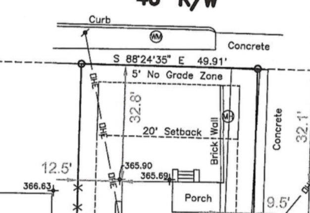
A boundary survey is a professional land measurement used to locate and formally establish the exact legal corners and property lines of a parcel of land. This survey ensures the buyer knows exactly what land they are purchasing and verifies the legal description matches the physical reality.
These surveys are used for land transfers, land divisions, subdivisions, loan closings, title insurance, property line identification, and boundary line disputes. Property improvements such as homes, garages, driveways, trees, and other additions are shown on these survey maps.
TOPOGRAPHIC SURVEY
A topographic survey is a detailed mapping process that measures the elevation, shape, and physical features of a specific piece of land. This survey includes, elevations and contours, natural features, man-made structures and utilities.
Topographic surveys are commonly used by architects and engineers to design building, road, and drainage systems that fit the natural landscape.

-
Recombination Plats
-
ALTA / ACSM Land Title Surveys
-
As-Built Surveys
-
Plot Plan
-
Rough Stake
-
Permanent Footing Stake
-
Form Check Verification
-
Pin Footing / Brick Points
-
Foundation Survey
-
Impervious Area Calculations / Certifications
-
Site Plans
-
FEMA Flood Elevation Certificates
-
Easement Maps & Surveys
